
Office: 570-836-5423
Mobile: 703-915-0826
123 Warren Street
Tunkhannock, PA 18657
Office: 570-836-5423
Mobile: 703-915-0826
123 Warren Street
Tunkhannock, PA 18657
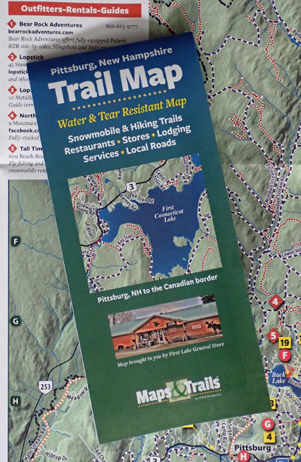
Many remote areas are better served with a printed map, especially when "off-trail" and beyond internet services. We create small, pocket-sized maps to slip into your gear while exploring rivers and trails as well as noting nearby services.
The new Pittsburg NH 2022 map covers the area from Pittsburg, NH north to the Canadian border. Pittsburg NH Maps & Trails is a pocket map printed on tear and water resistant paper. The map opens to 18"x24" and folds to a convenient 4"x9" size, perfect to slip into your pocket. This map is as accurate as possible from the publically available data as of November 2021 and shows trails, shops, lodging and services from Pittsburg, NH to the Canadian border. We also provide website presence for the map information, including business listings.
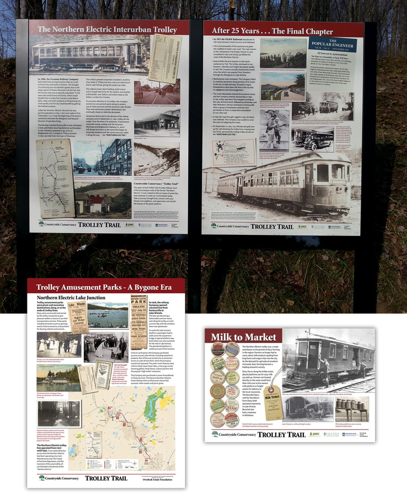
The Northern Electric Trolley ran from 1906 until about 1932 carrying passengers to the country from Scranton, and farm products back to the city. Stops included Keystone College and Factoryville, and Lake Winola. The Countryside Conservancy's Trolley Trail has signs about the history at most access parking areas and a few signs just off the parking lots.
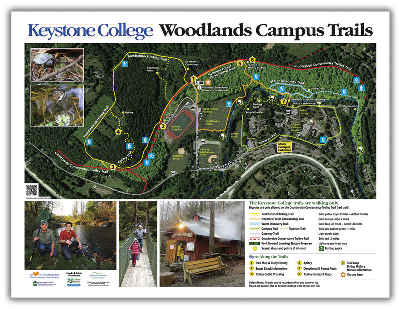
Keystone College has a wonderful trail system around campus and through the Woodlands Campus preserve area. The new trail signs direct and educate and cover topics from a new trail map, history of the suspension bridge, to information about flowers, bugs and bees. Watch for the new signs to be installed over the next few months.
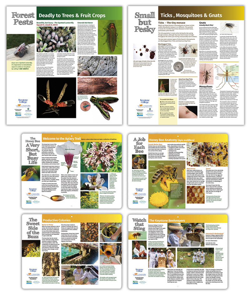
The new Keystone Trail map shows the trail information, along with the length and difficulty, and the location of the new interpretive and informational signs.
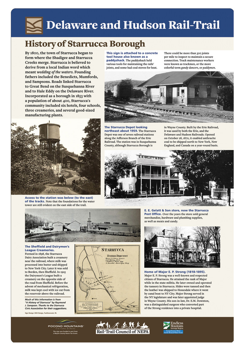
The newest sign for the Delaware and Hudson Rail-Trail presents the history of Starrucca.